This topic describes the background information, framework, and benefits of GanosBase.
Background information
GanosBase is a new-generation spatio-temporal database engine developed by Alibaba Cloud. It incorporates spatio-temporal data processing capabilities into PolarDB. It provides integrated capabilities of storage, querying, analysis, and rendering for new spatio-temporal multi-modal data. Ganos in GanosBase combines the letters of Gaea (the Greek goddess of the earth) and Chronos (the Greek god of time) and implies the deep combination of space and time.
Spatial data and spatio-temporal data
Spatial data is used to define the spatial characteristics such as the location, shape, distribution and associated information of objects in the defined space. Spatial data describes all things and phenomena in the real world and of positioning significance. For example, in a database, spatial data can record all schools in a city, with each row representing a school. Geometry fields can be used to store the spatial outline of each school (generally a polygon with spatial reference information), and other fields are used to record information such as the name, floor area, and founding date of a school. Spatial data is generally selected for different scenarios depending on the spatial expression methods of real things, and is further divided into modal structures such as geometry data, raster data, and grid data.
Spatio-temporal data refers to spatial data that considers the changes of things or phenomena over time. Common examples of spatio-temporal data are data of moving objects, such as people, vehicles, ships, and aircraft. In most cases, spatio-temporal data records a series of spatio-temporal positions (latitude and longitude coordinates and timestamps) that a moving object passes through and various types of attribute information or monitoring information associated with the positions in a database. For example, in a database that records the trip information of all shared bicycles, each trip (from the starting point to the destination) is saved as a row. Trajectory data is used to record a series of points of each trip. Associated monitoring items, such as vehicle speeds and directions, are recorded together with each point.
In a sense, spatio-temporal data is a superset of spatial data. In this manual, spatial data is referred to as spatio-temporal data unless it is otherwise specified, and GanosBase is defined as the spatio-temporal database engine.
Challenges of spatio-temporal data management

What can GanosBase do
GanosBase provides integrated capabilities of storage, querying, analysis, and rendering for new spatio-temporal multi-modal data. It solves the problems with spatio-temporal data use such as complex processes, high technical requirements, and low efficiency. It can be widely used in urban management, transportation and logistics, shared mobility, natural resources, aerospace, IoT, and information technology.
Pricing
PolarDB for PostgreSQL provides GanosBase free of charge.
Framework
GanosBase incorporates integrated capabilities of storage, querying, analysis, and rendering for new spatio-temporal multi-modal data.
Core components
Geometry engine
The geometry engine provides storage and computing capabilities for vector data such as points, lines, planes, and volumes. It supports various geometry data formats such as SHP, GeoJSON, WKT, and WKB. The geometry engine is fully compatible with PostGIS functions and has definite advantages in spatial data caching, spatial indexing, and spatial parallel computing. It can improve the query and analysis performance of large-scale vector data by more than five times.

Raster engine
The raster engine provides storage and computing capabilities for remote sensing images, digital elevation models (DEMs), and grid data. It is compatible with multiple raster data source formats such as Tiff, HDF4, HDF5, GRIB, and NetCDF. The raster engine provides object-oriented storage capabilities, and supports OSS-based raster data lake scaling. A single row can store a large object of more than 1 TB. The raster engine also provides a variety of basic operators involving raster spatial relationship identification, raster pyramid, raster statistics, raster attributes, raster image processing, raster algebra, as well as business algorithms such as color balancing, mosaic, DEM algorithms, and D8 catchment algorithms. It has distinct advantages in large-scale raster data storage and computing scenarios.
Moving object engine
The moving object engine mainly provides data storage and computing capabilities for moving objects such as people, vehicles, ships, and aircraft. The moving object engine provides native storage, indexing, and segmentation optimization for 4D trajectories (2D or 3D and time). It can add custom attributes to each trajectory point, define spatio-temporal events, efficiently compress and resample tens of billions of trajectory points, and support various native spatio-temporal operators, such as trajectory segmentation, trajectory stay points, trajectory similarity, and spatio-temporal relationship identification.
GeomGrid engine
The GeomGrid engine mainly provides spatial grid construction and the grid coding and query capabilities for 2D and 3D spatial objects. The GeomGrid engine supports multiple meshing rules (such as GeoSOT and H3), spatial object encoding, object and code query operations, aggregation and analysis capabilities based on spatial grids, and grid degeneration capabilities.
Surface model engine
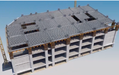
The surface model engine provides the storage and computing capabilities for semantic 3D data expressed in surface meshes. The surface model engine can process building information modeling (BIM) data, deconstruct and structure models based on semantics, support complex 3D spatial analysis and large-scale federated retrieval, provide model simplification algorithms, and interface with mainstream front-end 3D rendering engines.
Volume model engine
The volume model engine mainly provides the storage and computing capabilities for anisotropic data characterized by non-homogeneous volume meshes. The volume model engine can process complex geological volume data, support grid truncation at sequence boundaries, support business interpolation algorithms, support complex spatial analysis and large-scale federated retrieval, provide model simplification algorithms, and interface with mainstream front-end 3D rendering engines.
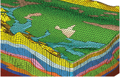
The volume model engine is in the invitational preview phase. To use the model, contact us.
Scene model engine
The scene model engine mainly provides the storage and computing capabilities for refined rendering models. The scene model engine can import models in multiple formats, such as OSGB, glTF/GLB, and OBJ, support algorithms such as space clipping and merging, texture clipping and simplification, provide model simplification algorithms, and interface with mainstream front-end 3D rendering engines. It also supports accurate analysis on visibility and shadow ratios.

Point cloud engine
The point cloud engine mainly provides the storage and computing capabilities for massive point cloud data collected by LADAR systems. The point cloud engine supports block spatial indexing in databases, point cloud compression loss, point cloud spatial query and calculation, point cloud thinning and simplification, and can be connected to mainstream front-end 3D rendering engines.

Path engine
The path engine mainly provides the storage and computing capabilities for topological graph data expressed in points and edges (such as pipe networks and road networks). The path engine can build network topologies based on point and edge models, and support multiple pathfinding algorithms such as TSP, K-shortest, turn restriction, and bidirectional Dijkstra's.
Quick display engine
The quick display engine supports quick rendering of spatial data in GanosBase. For vector and raster data, the quick display engine performs hierarchical aggregation based on spatial characteristics. It uses visibility culling algorithms to build fast display indexes without pre-tiling to support rendering, and local updates of the indexes are supported. For various types of 3D data, the fast display engine constructs rendering levels for 3D models by using model simplification, texture compression, and data stitching, and dynamically generates a display format that the rendering engine can recognize. The quick display engine changes the traditional display mode of pre-tiling and provides integrated visualization and computing capabilities to ensure data verisimilitude.

End-to-end capabilities
Atlas is a lightweight spatio-temporal data analysis and visualization service jointly launched by GanosBase and DataV teams. It helps Internet customers quickly discover the value of spatio-temporal data and can assist business location decision-making, scientific research, and other applications. It can also be integrated into user spatio-temporal applications. Atlas is designed to quickly solve the problems with large-scale spatio-temporal data analysis, visualization, and achievement sharing. It provides the following core capabilities:
Graphical preview of large-scale spatio-temporal data
Visualization and analysis of spatio-temporal data in GanosBase by using SQL statements
Various expressions of spatio-temporal data by using primitives such as points, lines, surfaces, raster, and grids
Atlas pushes down all spatio-temporal data computing to GanosBase to maximize the efficiency of spatio-temporal computing. It uses the dynamic fast display technology in GanosBase to interface with the front-end, plot various types of spatio-temporal data, and truly realize the fast graphing with SQL statements. In addition to direct preview of various types of spatio-temporal data, Atlas can also draw business maps such as cloud maps, trajectory density maps, and grid aggregation maps, and share such maps.
Benefits
Unified management
Various types of spatio-temporal multi-modal data
GanosBase supports different data types (such as geometry, raster, trajectory, and geographic grid), storage structures, and function capabilities. GanosBase can replace the traditional technical framework that involves multiple data types and multiple storage methods. It provides unified management on various spatio-temporal data types, reducing business complexity and O&M costs.
Compliance with OpenGIS standards and full compatibility with the PostGIS syntax
GanosBase supports the transparent migration of existing PostGIS geometry applications, supports 2D, 3D, and 4D coordinate spaces, allows you to create 2D and n-D spatial indexes, and supports planar and spherical computing. You can control the spatial computing accuracy. Compared with PostGIS, GanosBase improves the performance by more than five times in various common spatio-temporal query scenarios.
Powerful, flexible, simple, and specialized management of grid data
GanosBase can import multiple types of raster data, such as HDF4, HDF5, GRIB, and NC. It supports transparent query processing based on OSS. It can manage large raster objects with a single row of more than 1 TB and improve the performance by more than 10 times in parallel operation mode. It supports a variety of basic raster operators and business algorithms such as image mosaic, clipping, color balancing, and DEM processing.
Integrated storage, computing, and rendering of 3D data
GanosBase can import common 3D model data types, such as IFC (BIM), GLFT, GLB, OBJ, OSGB, and 3D geological models. After data is imported, it can perform complex 3D analysis and 3D queries, and its quick display engine can provide rendering capabilities without pre-tiling. GanosBase improves the computing efficiency of 3D data by more than 50 times than traditional solutions.
Diversified geographic meshing, coding, and aggregation capabilities
GanosBase supports multiple meshing rules such as GeoSOT and H3. It can quickly code hundreds of millions of 2D and 3D spatial objects based on grids, perform real-time aggregation queries based on grid codes, and interface with the MVT fast display technology to implement efficient rendering of aggregation attributes.
Trajectory management and visualization of a large number of moving objects
GanosBase implements trajectory management for various moving objects, such as people, vehicles, ships, and aircraft, in up to four-dimensions. GanosBase supports complex computing of trajectories, events, and polymorphic attributes, such as complex storage, compression, segmentation, similarity judgment, and stationary point judgment. Compared with the traditional point model, the native trajectory model improves the performance by nearly 50 to 100 times in spatio-temporal analysis scenarios.
Polymorphic tiered storage of spatial data
GanosBase provides polymorphic tiered storage of spatial data in PolarDB for PostgreSQL. The database service not only supports Elastic Block Storage, but also allows you to store data in Object Storage Service (OSS). You can store partitions in a partitioned table on OSS, or store spatio-temporal large columns in the table on OSS. You can also perform create, read, update, delete, and index operations on such data stored on OSS. The multi-level cache ensures performance and is fully transparent to customers. Polymorphic tiered storage can greatly reduce storage costs and ensure data operations.

Computing pushdown
Unlike traditional spatio-temporal middleware solutions, GanosBase allows you to push down critical computing to the database service. This brings computing closer to data and makes full use of the processing capabilities of the database service to implement local and efficient data computing. GanosBase not only reduces I/O latency caused by the transmission of a large amount of intermediate data over the network, but also simplifies business logic and greatly improves business performance.
Abundant operators to support various types of spatio-temporal analysis
GanosBase supports abundant spatial analysis operators, including those for import and export, data type conversion, attribute processing, spatial relationship identification, spatial computing, spatial processing, and business analysis. You can independently build more complex business algorithms based on these operators. Customer practices show that the business algorithms built based on GanosBase operators can significantly improve efficiency.
Elastic parallel queries for spatio-temporal data
GanosBase can use the multi-node elastic parallel query (ePQ) feature of PolarDB to query spatio-temporal data. This involves the use of read-only nodes in complex analytic queries to improve query efficiency. Compared with the single-node elastic parallel query feature, ePQ accelerates 19 queries by more than 10 times and 3 queries by more than 60 times in 22 types of queries. The performance increases linearly with resource expansion.

HTAP for spatio-temporal data
In combination with PolarDB for PostgreSQL and AnalyticDB for PostgreSQL, GanosBase delivers HTAP capabilities for spatio-temporal data. GanosBase not only directly supports PolarDB for PostgreSQL, but also allows you to add AnalyticDB for PostgreSQL nodes to the database service. This way, you can use HTAP to synchronize and integrate spatio-temporal data on TP and AP nodes.

Integrated visualization and computing
GanosBase provides the 2D/3D fast display engine without pre-tiling. It can efficiently retrieve and visualize the entities represented by spatio-temporal data. Instead of using the complex method of file system storage, database computing, and tile viewing in the traditional technology stack, it employs integrated visualization and computing to support various business applications such as spatial queries, spatio-temporal queries, scenario-oriented queries, and integrated multi-modal queries.
Quick display indexes
GanosBase builds sparse pyramid indexes based on visibility culling algorithms to support visualized access to hundreds of millions of polygon objects in seconds and parallel updates of hundreds of millions of fast display indexes in minutes.
MVT enhancement
GanosBase provides PostGIS MVT enhancement capabilities to visualize spatio-temporal query results. GanosBase supports acceleration algorithms such as global resampling and allows you to dynamically generate vector 2D or 3D tiles at a faster speed and in smaller sizes.
3D rendering without pre-tiling
GanosBase provides multiple capabilities for 3D data, such as in-library simplification, texture reorganization, data stitching, and LOD construction. It also can dynamically generate 3D tile-connected rendering engines.
Contact us
You can contact us if you have any questions.