By digoal
Geospatial applications are playing an increasingly important role in urban planning and construction.


PostGIS is an open-source, freely available, and fairly Open Geospatial Consortium (OGC) compliant spatial database extender for PostgreSQL database management system.
It adds support for geographic objects in the PostgreSQL object-relational database. Besides, it follows the Simple Features for SQL specification from Open Geospatial Consortium (OGC).
PostGIS supports the following geometry constructors: http://postgis.net/docs/manual-2.4/reference.html
8.4. Geometry Constructors

ST_GeogFromText — Return a specified geography value from Well-Known Text representation or extended (WKT).
ST_GeographyFromText — Return a specified geography value from Well-Known Text representation or extended (WKT).
ST_GeogFromWKB — Creates a geography instance from a Well-Known Binary geometry representation (WKB) or extended Well Known Binary (EWKB).
ST_GeomFromTWKB — Creates a geometry instance from a TWKB ("Tiny Well-Known Binary") geometry representation.
ST_GeomCollFromText — Makes a collection Geometry from collection WKT with the given SRID. If SRID is not given, it defaults to 0.
ST_GeomFromEWKB — Return a specified ST_Geometry value from Extended Well-Known Binary representation (EWKB).
ST_GeomFromEWKT — Return a specified ST_Geometry value from Extended Well-Known Text representation (EWKT).
ST_GeometryFromText — Return a specified ST_Geometry value from Well-Known Text representation (WKT). This is an alias name for ST_GeomFromText
ST_GeomFromGeoHash — Return a geometry from a GeoHash string.
ST_GeomFromGML — Takes as input GML representation of geometry and outputs a PostGIS geometry object
ST_GeomFromGeoJSON — Takes as input a geojson representation of a geometry and outputs a PostGIS geometry object
ST_GeomFromKML — Takes as input KML representation of geometry and outputs a PostGIS geometry object
ST_GMLToSQL — Return a specified ST_Geometry value from GML representation. This is an alias name for ST_GeomFromGML
ST_GeomFromText — Return a specified ST_Geometry value from Well-Known Text representation (WKT).
ST_GeomFromWKB — Creates a geometry instance from a Well-Known Binary geometry representation (WKB) and optional SRID.
PostGIS supports the following geometry outputs:
8.7. Geometry Outputs

ST_AsBinary — Return the Well-Known Binary (WKB) representation of the geometry/geography without SRID meta data.
ST_AsEncodedPolyline — Returns an Encoded Polyline from a LineString geometry.
ST_AsEWKB — Return the Well-Known Binary (WKB) representation of the geometry with SRID meta data.
ST_AsEWKT — Return the Well-Known Text (WKT) representation of the geometry with SRID meta data.
ST_AsGeoJSON — Return the geometry as a GeoJSON element.
ST_AsGML — Return the geometry as a GML version 2 or 3 element.
ST_AsHEXEWKB — Returns a Geometry in HEXEWKB format (as text) using either little-endian (NDR) or big-endian (XDR) encoding.
ST_AsKML — Return the geometry as a KML element. Several variants. Default version=2, default precision=15
ST_AsLatLonText — Return the Degrees, Minutes, Seconds representation of the given point.
ST_AsSVG — Returns a Geometry in SVG path data given a geometry or geography object.
ST_AsText — Return the Well-Known Text (WKT) representation of the geometry/geography without SRID metadata.
ST_AsTWKB — Returns the geometry as TWKB, aka "Tiny Well-Known Binary"
ST_AsX3D — Returns a Geometry in X3D xml node element format: ISO-IEC-19776-1.2-X3DEncodings-XML
ST_GeoHash — Return a GeoHash representation of the geometry.
ST_AsGeobuf — Return a Geobuf representation of a set of rows.
ST_AsMVTGeom — Transform a geometry into the coordinate space of a Mapbox Vector Tile.
ST_AsMVT — Return a Mapbox Vector Tile representation of a set of rows.
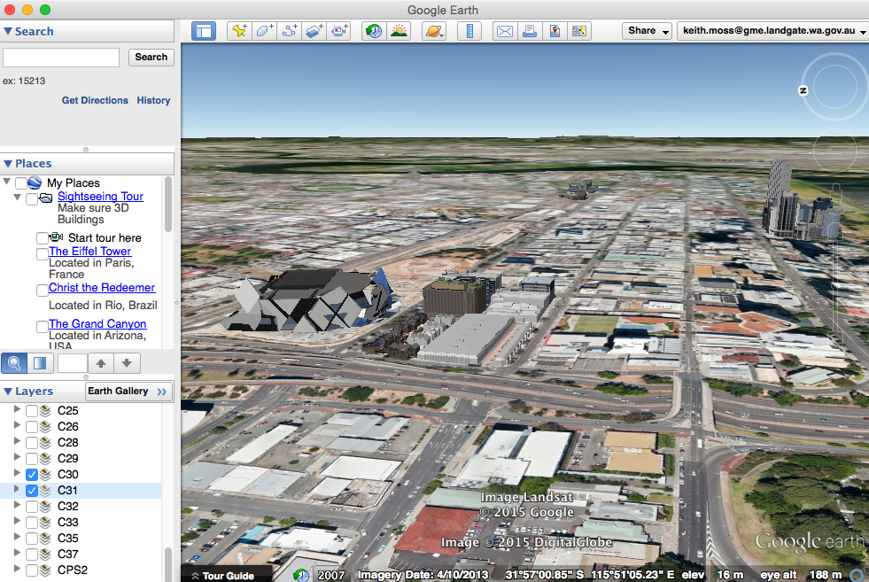
PostGIS, combined with geospatial applications, can facilitate urban planning and construction.
Some PostGIS-related materials are provided as follows:
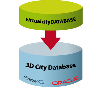
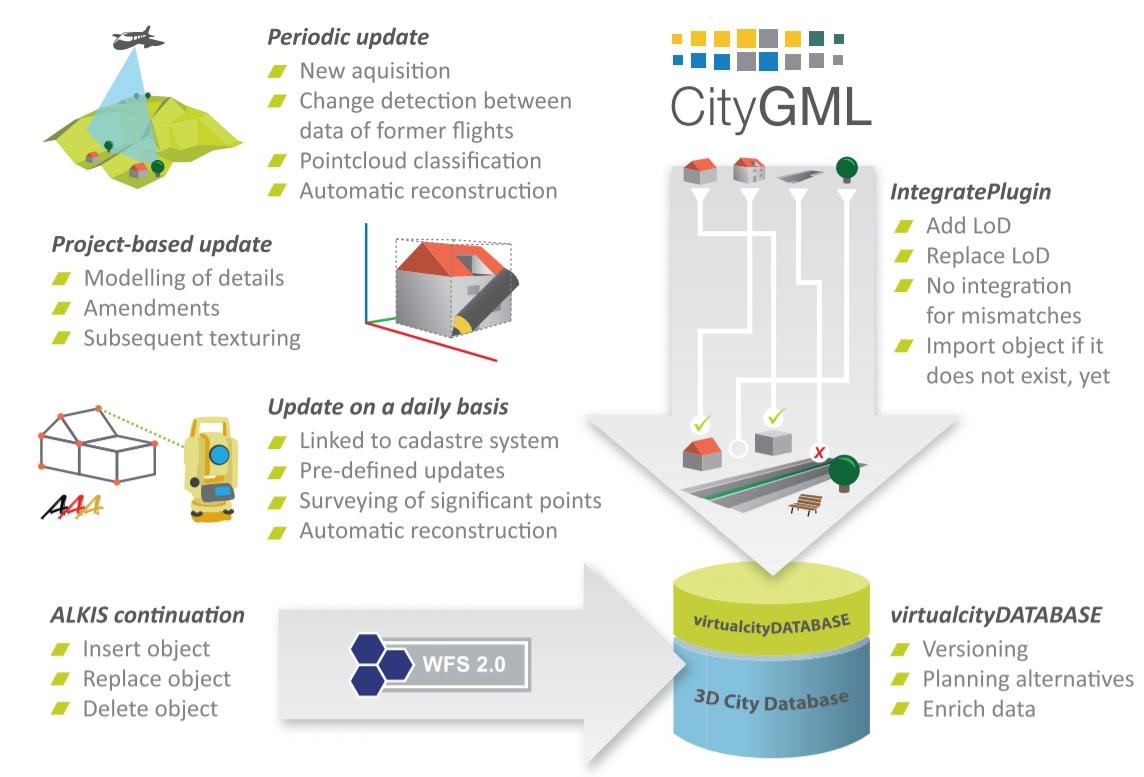
2) 3D City Database for CityGML
6) Visual City
9) Virtual City Data Compatibility
1) The OGC (Open Geospatial Consortium) is an international not-for-profit organization committed to making quality open standards for the global geospatial community.
2) CityGML - City Geography Markup Language.
3) CityJSON is a format for encoding a subset of the CityGML data model using JavaScript Object Notation (JSON).
Here are several resources that can be useful to help you better understand PostGIS, 3DCity modeling, and other related info.
1) https://en.wikipedia.org/wiki/PostGIS
2) https://goldsaucer.co.uk/projects/#content
3) https://github.com/TerriaJS/terriajs/issues/673
4) http://www.bluemarblegeo.com/about-us/index.php
5) https://github.com/3dcitydb
6) https://www.3dcitydb.org/3dcitydb/3dcitydb-in-action/
8) http://www.virtualcitysystems.de/en/
9) Build a GIS App using OpenScales+MapServer+PostGIS
10) WebGIS (PostgreSQL+GeoServer+OpenLayers) Part 2: GeoServer Installation and Configuration (Repost)
11) Building a 3D GIS Application Using Geoserver and Google Earth
ApsaraDB - September 21, 2022
digoal - February 13, 2021
Alibaba Clouder - January 7, 2021
digoal - January 18, 2021
Alibaba Clouder - January 8, 2019
digoal - May 28, 2019
 PolarDB for PostgreSQL
Alibaba Cloud PolarDB for PostgreSQL is an in-house relational database service 100% compatible with PostgreSQL and highly compatible with the Oracle syntax.
Learn More AnalyticDB for PostgreSQL
An online MPP warehousing service based on the Greenplum Database open source program
Learn More ApsaraDB RDS for PostgreSQL
An on-demand database hosting service for PostgreSQL with automated monitoring, backup and disaster recovery capabilities
Learn More Database for FinTech Solution
Leverage cloud-native database solutions dedicated for FinTech.
Learn MoreMore Posts by digoal